File:Geodesy Collection Pitcairn Island.jpg
Jump to navigation
Jump to search

Size of this preview: 632 × 600 pixels. Other resolutions: 253 × 240 pixels | 506 × 480 pixels | 809 × 768 pixels | 1,024 × 972 pixels.
Original file (1,024 × 972 pixels, file size: 155 KB, MIME type: image/jpeg)
Summary
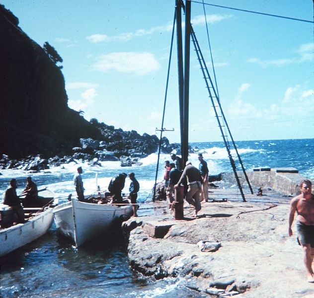
| Description | Landing on Pitcairn Island |
| Date | Unknown date |
| Source | http://www.photolib.noaa.gov/htmls/geod0154.htm |
| Author | NOAA |
| Permission (Reusing this file) |
see NOAA's About the Images |
Licensing
This image is in the public domain because it contains materials that originally came from the U.S. National Oceanic and Atmospheric Administration, taken or made as part of an employee's official duties.
|
Original upload log
(All user names refer to en.wikipedia)
- 2004-10-26 08:17 Chris 73 1024×972×8 (158629 bytes) pitcairn island
File history
Click on a date/time to view the file as it appeared at that time.
| Date/Time | Thumbnail | Dimensions | User | Comment | |
|---|---|---|---|---|---|
| current | 11:16, 18 September 2007 | | 1,024 × 972 (155 KB) | Liftarn | {{Information |Description=en:Pitcairn Islands Image ID: geod0154, Geodesy Collection, Station Number 039 Location: Pitcairn Island Source: [http://www.photolib.noaa.gov/geodesy/geod0154.htm NOAA] |Source=Originally from [http://en.wikipedia.org en |
Pages using this file
The following page uses this file: