File:Map France 1030-fr.svg
Jump to navigation
Jump to search


Size of this PNG preview of this SVG file: 526 × 599 pixels. Other resolutions: 211 × 240 pixels | 422 × 480 pixels | 527 × 600 pixels | 674 × 768 pixels | 899 × 1,024 pixels | 989 × 1,126 pixels.
Original file (SVG file, nominally 989 × 1,126 pixels, file size: 718 KB)
Légende
Summary
| Description |
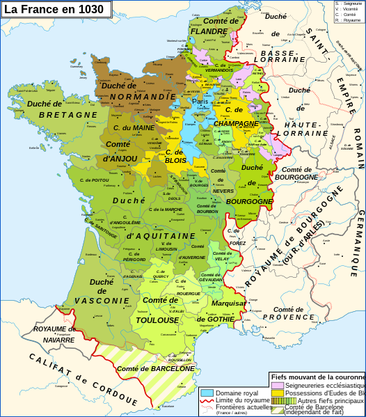
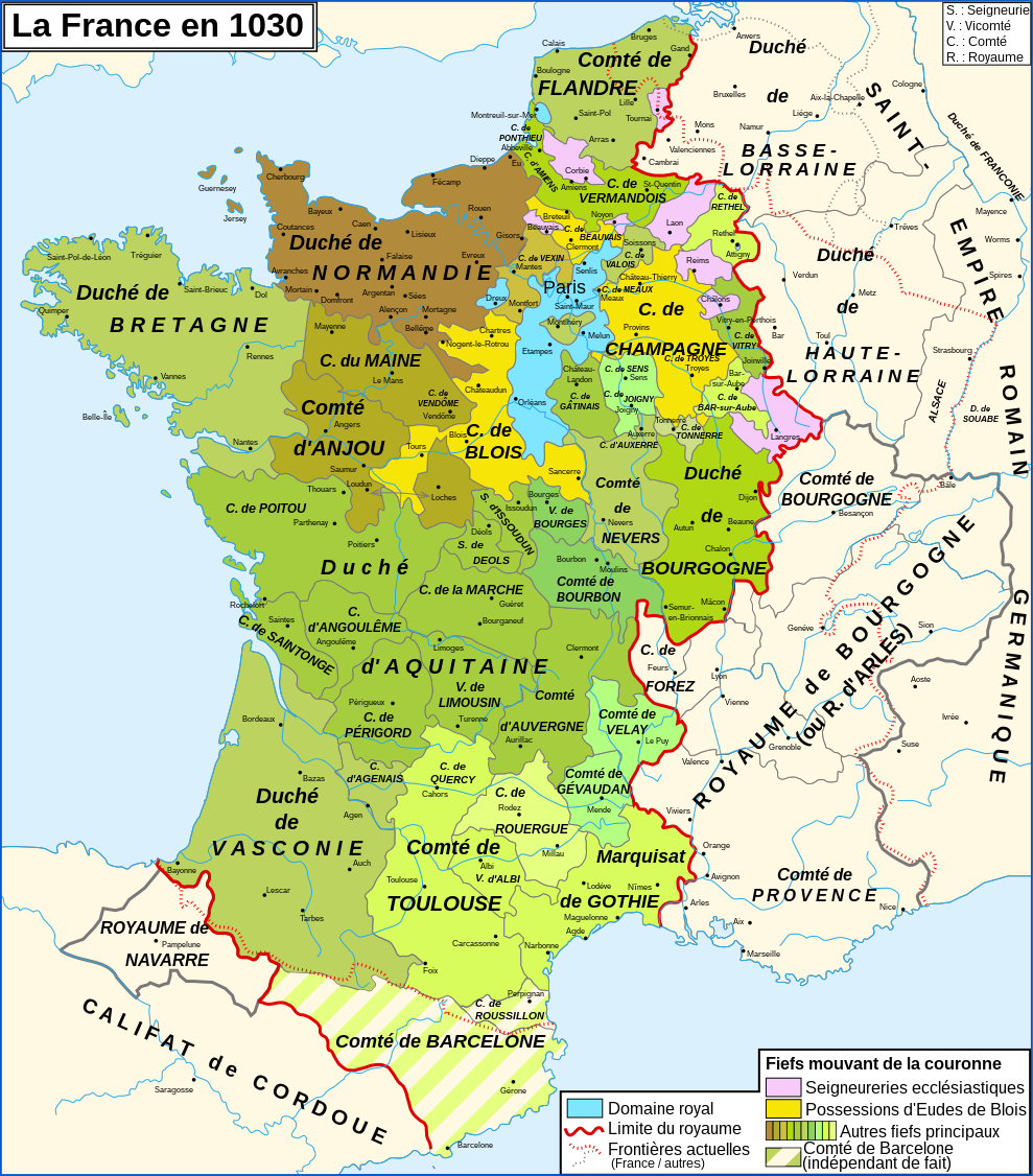
English: Map of the France in 1030
Français : Carte de la France en 1030 |
| Date | |
| Source |
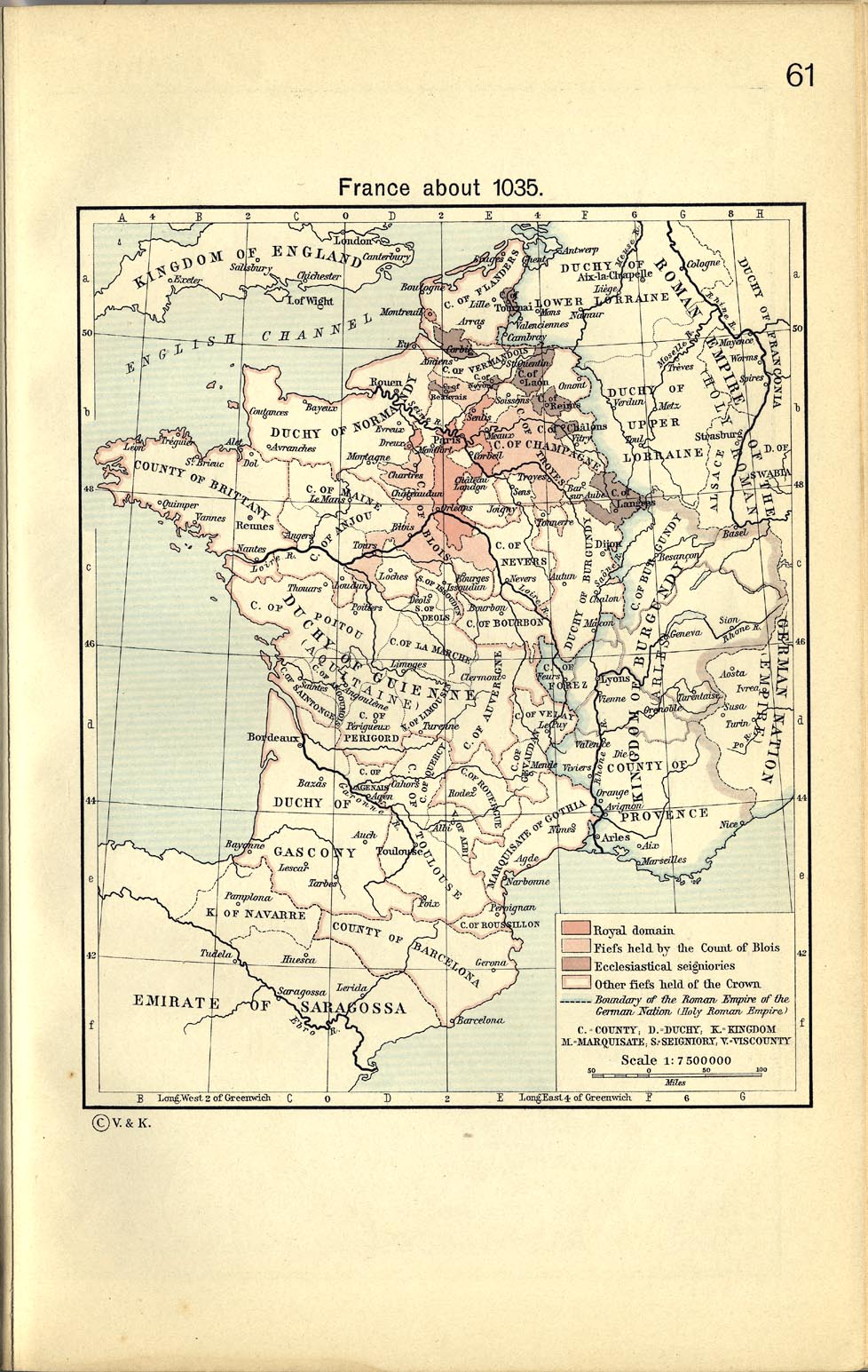
English: Own work, from France about 1035, in William R. Shepherd, The Historical Atlas, 1911
Data from the same and:
Français : Création personnelle, d'après France about 1035, in William R. Shepherd, The Historical Atlas, 1911
Données d'après cette source et :
|
| Author | Zigeuner |
| Other versions |
[]
|


|
This SVG file contains embedded text that can be translated into your language, using any capable SVG editor, text editor or the SVG Translate tool. For more information see: About translating SVG files. |
Licensing
I, the copyright holder of this work, hereby publish it under the following licenses:

|
Permission is granted to copy, distribute and/or modify this document under the terms of the GNU Free Documentation License, Version 1.2 or any later version published by the Free Software Foundation; with no Invariant Sections, no Front-Cover Texts, and no Back-Cover Texts. A copy of the license is included in the section entitled GNU Free Documentation License. |
This file is licensed under the Creative Commons Attribution-Share Alike 3.0 Unported, 2.5 Generic, 2.0 Generic and 1.0 Generic license.
- You are free:
- to share – to copy, distribute and transmit the work
- to remix – to adapt the work
- Under the following conditions:
- attribution – You must give appropriate credit, provide a link to the license, and indicate if changes were made. You may do so in any reasonable manner, but not in any way that suggests the licensor endorses you or your use.
- share alike – If you remix, transform, or build upon the material, you must distribute your contributions under the same or compatible license as the original.
You may select the license of your choice.
File history
Click on a date/time to view the file as it appeared at that time.
| Date/Time | Thumbnail | Dimensions | User | Comment | |
|---|---|---|---|---|---|
| current | 12:35, 4 March 2022 | | 989 × 1,126 (718 KB) | Taisai429 | Reverted to version as of 14:07, 9 August 2014 (UTC) |
Pages using this file
The following page uses this file: