File:Reliefkarte Italien.png
Jump to navigation
Jump to search


Size of this preview: 472 × 599 pixels. Other resolutions: 189 × 240 pixels | 378 × 480 pixels | 473 × 600 pixels | 605 × 768 pixels | 807 × 1,024 pixels | 2,949 × 3,743 pixels.
Original file (2,949 × 3,743 pixels, file size: 10.27 MB, MIME type: image/png)
Summary
| Description |
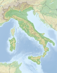
Deutsch: Reliefkarte Italien
Topographischer Hintergrund: NASA Shuttle Radar Topography Mission (public domain). SRTM3 v.2. |
||||||||
| Date | |||||||||
| Source | Own work | ||||||||
| Author | Tschubby | ||||||||
| Permission (Reusing this file) |
I, the copyright holder of this work, hereby publish it under the following licenses:
This file is licensed under the Creative Commons Attribution-Share Alike 2.5 Generic, 2.0 Generic and 1.0 Generic license.
You may select the license of your choice. |

File history
Click on a date/time to view the file as it appeared at that time.
| Date/Time | Thumbnail | Dimensions | User | Comment | |
|---|---|---|---|---|---|
| current | 18:04, 18 May 2018 | | 2,949 × 3,743 (10.27 MB) | Tschubby | == {{int:filedesc}} == {{Information |Description= {{de| Reliefkarte Italien}} Topographischer Hintergrund: [http://www2.jpl.nasa.gov/srtm NASA Shuttle Radar Topography Mission] (public domain). SRTM3 v.2.<br /> Grenzverläufe: File:Italy location map.svg |Source={{own}} |Date= 2018-05-18 |Author= Tschubby |Permission= {{self|GFDL|Cc-by-sa-3.0-migrated|Cc-by-sa-2.5,2.0,1.0}} |other_versions= }} [[Category:Topographic maps of Ita... |
Pages using this file
The following page uses this file: